Travel in Switzerland: New app shows all the country’s most useful maps
The multi-functional free application features all Swiss regions, as well as numerous activities available in each area.
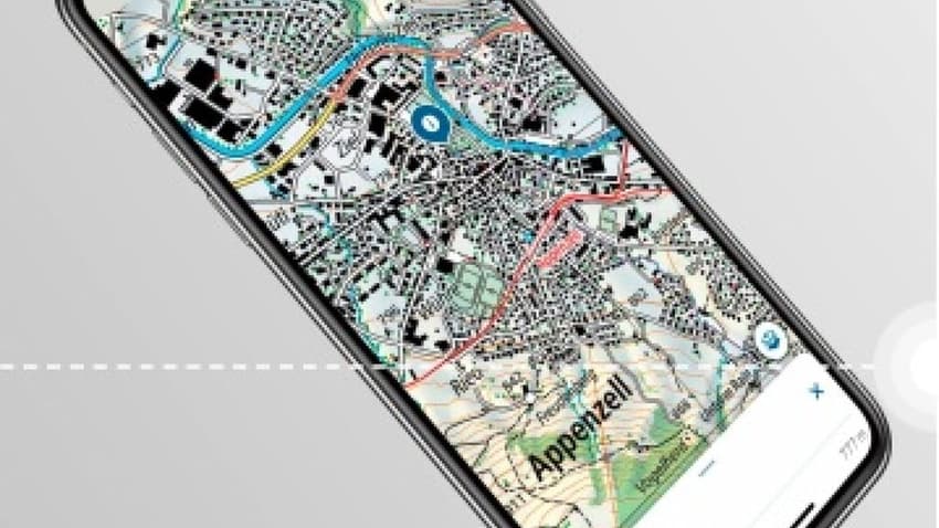
Created by the Federal Office of Topography (swisstopo), the app displays all national maps, in addition to aerial photographs, aeronautical charts, and historical maps.
It also has data about public transportation in a given area, and information relating to hiking trails, cycling paths, designated wildlife areas, ski and snowshoe routes, and even landing sites for drones.
Schon ausprobiert?
Jetzt die neue swisstopo-App herunterladen: https://t.co/2BVFBUgeD0#swisstopoapp pic.twitter.com/mQBEYs6fHO
— swisstopo (@swisstopo) July 25, 2020
The map can be used not only to orientate yourself in a particular region, but also to create a personalised tour following the road and path network. Additionally, the app shows the length, altitude difference, and a calculated approximate walking or driving time.
According to swisstopo, most of the app’s functions can be used offline. Even GPS tracking does not require an Internet connection. However, the map content must be downloaded beforehand from the internet. Maps can only be used offline if you have stored them.
The app can be downloaded from the App Store for iPhone and iPad, and from Google Play for Android Smartphones/Tablets.
You can find more detailed information about the content here.
READ MORE: Switzerland's ten most beautiful villages you have to visit
Comments
See Also
Created by the Federal Office of Topography (swisstopo), the app displays all national maps, in addition to aerial photographs, aeronautical charts, and historical maps.
It also has data about public transportation in a given area, and information relating to hiking trails, cycling paths, designated wildlife areas, ski and snowshoe routes, and even landing sites for drones.
Schon ausprobiert?
— swisstopo (@swisstopo) July 25, 2020
Jetzt die neue swisstopo-App herunterladen: https://t.co/2BVFBUgeD0#swisstopoapp pic.twitter.com/mQBEYs6fHO
The map can be used not only to orientate yourself in a particular region, but also to create a personalised tour following the road and path network. Additionally, the app shows the length, altitude difference, and a calculated approximate walking or driving time.
According to swisstopo, most of the app’s functions can be used offline. Even GPS tracking does not require an Internet connection. However, the map content must be downloaded beforehand from the internet. Maps can only be used offline if you have stored them.
The app can be downloaded from the App Store for iPhone and iPad, and from Google Play for Android Smartphones/Tablets.
You can find more detailed information about the content here.
READ MORE: Switzerland's ten most beautiful villages you have to visit
Join the conversation in our comments section below. Share your own views and experience and if you have a question or suggestion for our journalists then email us at [email protected].
Please keep comments civil, constructive and on topic – and make sure to read our terms of use before getting involved.
Please log in here to leave a comment.