Summer sun over for now: cooler temperatures and rain in Denmark this week
Temperatures of between 16 and 21 degrees Celsius with localised showers are forecast this week.
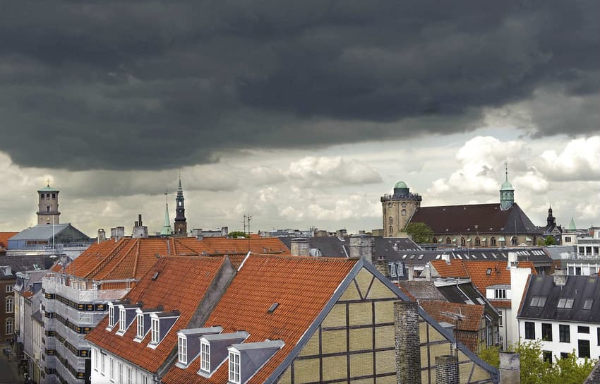
Cooler air and wet weather thereby replace the endless days of summer sunshine in which Denmark has basked for several weeks.
The change in weather will be seen from Monday.
Vejret skifter ? Koldfront deler landet. Mandag morgen ligger hele landet i den køligere luft og det bliver blæsende?️☁️? følg med , se https://t.co/h15CSJ8J4p pic.twitter.com/toNQfo5zTk
— DMI (@dmidk) June 10, 2018
“The high pressure zone we have seen for some time is gone. Instead, a low pressure zone is passing southern Scandinavia and will bring cooler air over the country from the south and southwest,” Martin Lindberg of the Danish Meteorologial Association (DMI) said.
Monday will be largely dry with some exceptions in the northern part of Jutland.
“We will see a lot of cloud, especially in the west, and only a little bit of sun in most of Jutland. Additionally, a strong wind from the North Sea will increase, making Jutland in particular feel colder,” Lindberg said.
Wednesday will be the most sunny day this week, although localised showers and cool winds will still be prevalent in west coast of Jutland.
“On Thursday there will be a deep low pressure area over the sea west of Norway. That will affect the weather in Denmark, although there will be some sun and fewer clouds in the eastern part of the country,” Lindberg continued.
But temperatures of between 17 and 21°C (on Thursday) will feel comfortable after the heat we’ve had up to now,” he added.
Thursday evening and Friday are likely to bring rain, the meteorologist added.
“We must hope for the sake of farmers and their dry land that there will be some rain after the dry period we’ve had up to now,” he said.
READ ALSO: Weather updates from Denmark
Comments
See Also
Cooler air and wet weather thereby replace the endless days of summer sunshine in which Denmark has basked for several weeks.
The change in weather will be seen from Monday.
Vejret skifter ? Koldfront deler landet. Mandag morgen ligger hele landet i den køligere luft og det bliver blæsende?️☁️? følg med , se https://t.co/h15CSJ8J4p pic.twitter.com/toNQfo5zTk
— DMI (@dmidk) June 10, 2018
“The high pressure zone we have seen for some time is gone. Instead, a low pressure zone is passing southern Scandinavia and will bring cooler air over the country from the south and southwest,” Martin Lindberg of the Danish Meteorologial Association (DMI) said.
Monday will be largely dry with some exceptions in the northern part of Jutland.
“We will see a lot of cloud, especially in the west, and only a little bit of sun in most of Jutland. Additionally, a strong wind from the North Sea will increase, making Jutland in particular feel colder,” Lindberg said.
Wednesday will be the most sunny day this week, although localised showers and cool winds will still be prevalent in west coast of Jutland.
“On Thursday there will be a deep low pressure area over the sea west of Norway. That will affect the weather in Denmark, although there will be some sun and fewer clouds in the eastern part of the country,” Lindberg continued.
But temperatures of between 17 and 21°C (on Thursday) will feel comfortable after the heat we’ve had up to now,” he added.
Thursday evening and Friday are likely to bring rain, the meteorologist added.
“We must hope for the sake of farmers and their dry land that there will be some rain after the dry period we’ve had up to now,” he said.
READ ALSO: Weather updates from Denmark
Join the conversation in our comments section below. Share your own views and experience and if you have a question or suggestion for our journalists then email us at [email protected].
Please keep comments civil, constructive and on topic – and make sure to read our terms of use before getting involved.
Please log in here to leave a comment.