Winter is here! Polar air brings storms, sleet and snow
The first snows of the season have begun to fall in Germany, as a cold front from the north moves across the country, bringing heavy rain, storms and snowfall at regions over 1,000 metres.
The cold polar air has reached the north of Germany and is moving south, bringing heavy showers and the possibility of sleet and one or two storms, DWD predicts.
Temperatures will reach highs of 5 to 11 C and most of the country will have cloudy skies throughout the day on Friday.
There will be a fresh west wind with strong gusts in the north and particularly on the coast and temperatures will drop to between -1C and 6C later on Friday.
In the night heading into Saturday, the cold air will reach the south and cloudy skies, showers and strong winds are predicted to continue across the south, while in the north the clouds are predicted to clear a little allowing for some sun between showers.
On Saturday over the south of Germany, warm air from the west will meet with the incoming cold air resulting in heavy rain. Temperatures will reach a maximum of 5C to 9C and frost is not likely.
In the Black Forest, stormy and unrelenting rain is predicted. It could rain up to 50 litres per square metre. Flooding is therefore not out of the question, Focus reports.
Aside from that, it will be windy in the south with stormy gusts moving in. Meanwhile in the north the chilly, rainy weather will continue. Sadly this does not come with the silver lining of snow.
On Sunday, the clouds will clear slightly for a few hours in the day across the north and east of Germany. At the same time snow is predicted to fall in areas as low as 700m above sea level meaning even some of Germany's lower mountains can expect a dusting of snow.
In the night leading into Monday, it will begin to snow in the valleys in the Alps. In the early hours of the morning, it will spread south towards Donau, in Swabia and also in Franken and the Operpalz.
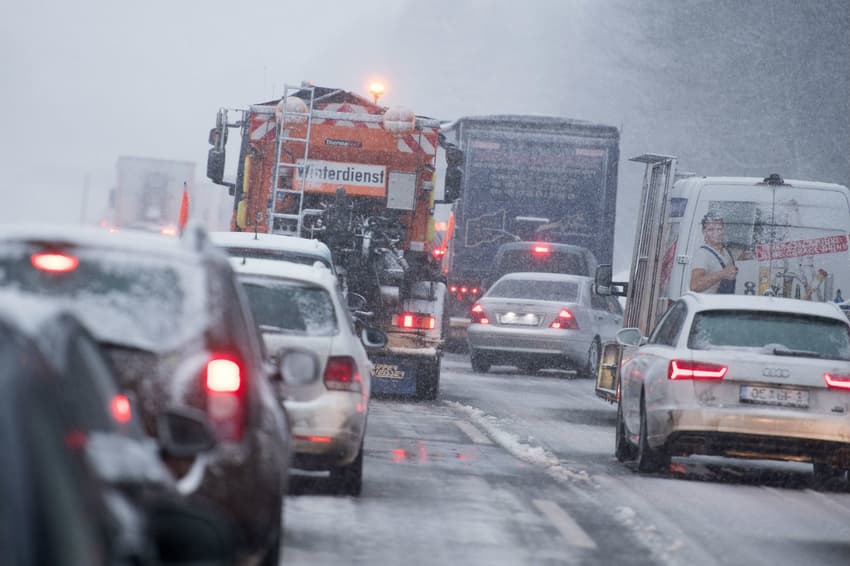
The snow isn't likely to stick around for long on lower ground, but traffic and rail disruptions are likely and air travel may have some delays due to de-icing measures.
Comments
See Also
The cold polar air has reached the north of Germany and is moving south, bringing heavy showers and the possibility of sleet and one or two storms, DWD predicts.
Temperatures will reach highs of 5 to 11 C and most of the country will have cloudy skies throughout the day on Friday.
There will be a fresh west wind with strong gusts in the north and particularly on the coast and temperatures will drop to between -1C and 6C later on Friday.
In the night heading into Saturday, the cold air will reach the south and cloudy skies, showers and strong winds are predicted to continue across the south, while in the north the clouds are predicted to clear a little allowing for some sun between showers.
On Saturday over the south of Germany, warm air from the west will meet with the incoming cold air resulting in heavy rain. Temperatures will reach a maximum of 5C to 9C and frost is not likely.
In the Black Forest, stormy and unrelenting rain is predicted. It could rain up to 50 litres per square metre. Flooding is therefore not out of the question, Focus reports.
Aside from that, it will be windy in the south with stormy gusts moving in. Meanwhile in the north the chilly, rainy weather will continue. Sadly this does not come with the silver lining of snow.
On Sunday, the clouds will clear slightly for a few hours in the day across the north and east of Germany. At the same time snow is predicted to fall in areas as low as 700m above sea level meaning even some of Germany's lower mountains can expect a dusting of snow.
In the night leading into Monday, it will begin to snow in the valleys in the Alps. In the early hours of the morning, it will spread south towards Donau, in Swabia and also in Franken and the Operpalz.
The snow isn't likely to stick around for long on lower ground, but traffic and rail disruptions are likely and air travel may have some delays due to de-icing measures.
Join the conversation in our comments section below. Share your own views and experience and if you have a question or suggestion for our journalists then email us at [email protected].
Please keep comments civil, constructive and on topic – and make sure to read our terms of use before getting involved.
Please log in here to leave a comment.